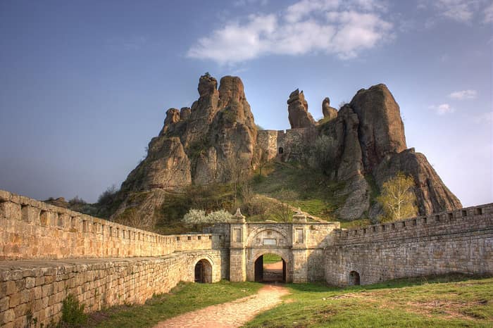
Belogradchik Fortress, the Stronghold Set Among Natural Rock Walls
Belogradchik Fortress, known locally as Kaleto, stands on the northern slopes of the Balkan Mountains beside the north-western Bulgarian town of Belogradchik. Begun in Roman times and enlarged by Bulgarian tsars and Ottoman engineers, it is one of the best-preserved strongholds in Bulgaria and a cultural monument of national importance. Together with the Belogradchik Rocks it draws most visitors to the region.
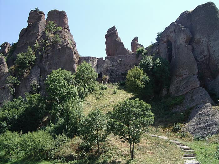
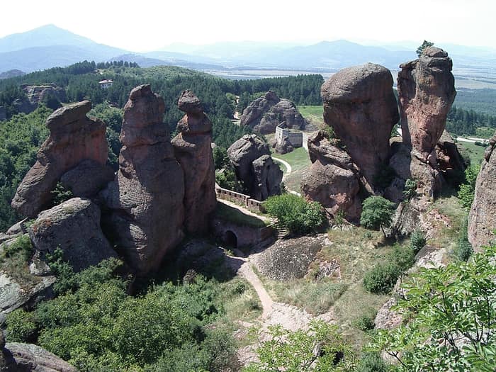
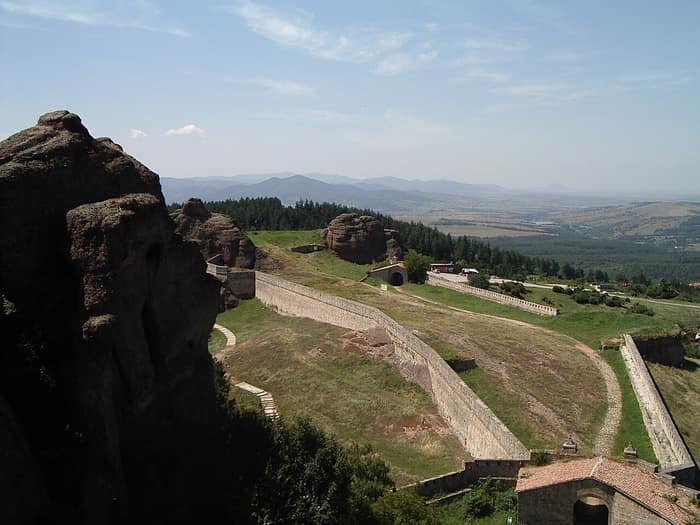
This fortress needed walls on only two sides, because towering natural rocks, up to 70 metres high, guarded the rest. Its builders simply let the mountain do most of the work.
The history of Belogradchik Fortress
The first fortress was built when this region belonged to the Roman Empire; German Wikipedia places it between the first and third centuries CE, while the Polish article names the third. The builders used the natural rock formations as protection. Walls were raised only on the north-west and south-east sides, because the rest of the courtyard is enclosed by rocks up to 70 metres high. At first the fortress was mainly a lookout rather than a purely defensive work, and it is said to have watched the road from Ratiaria. Excavations found wall foundations, pottery, iron spear and arrow heads, and coins of the emperors Vespasian, Trajan, Septimius Severus, Gordian III and Decius.
In the fourteenth century Tsar Ivan Sratsimir of Vidin extended the old fortress, building fortified garrison posts in front of the existing rock masses. Under his rule it became one of the most important strongholds in the region, second only to his capital fortress, Baba Vida in Vidin. The fortress name first appears in the chronicle of a Hungarian annalist describing the campaign of Louis I of Anjou, who took Vidin in June 1365; the record lists the stronghold of Fehérvár, usually identified with Belogradchik, among the places captured afterwards. Rebellious Bulgarians drove the garrison out in 1369.
The Ottomans captured the fortress in 1396 and partly destroyed it, but they later had to expand it because of growing hajduk and insurgent activity in the area. The biggest changes came between 1805 and 1837, when the fortress was reorganised and enlarged under the guidance of French and Italian engineers. New walls of stone blocks and mortar, gun platforms, firing steps at the loopholes, underground stores for ammunition and food, and a belt of buried wooden stakes strengthened its defences. Inside there were guardrooms with hearths, a granary, a wheat and salt mill, a stable, a well and two rainwater cisterns.
The fortress played an important part in the Ottoman suppression of the Belogradchik Uprising of 1850. In 1862 the so-called Suleiman fortification was added to strengthen the western part, and during the Russo-Ottoman War of 1877–1878 it was besieged by Russian and Romanian troops. It was last used in warfare during the Serbo-Bulgarian War of 1885. Later restored, it is now a cultural monument of national importance managed by the local historical museum, and it belongs to the Hundred National Tourist Sites of Bulgaria.
Curious facts about Belogradchik Fortress
- The locals call the fortress Kaleto, from the Turkish word kale, meaning fortress.
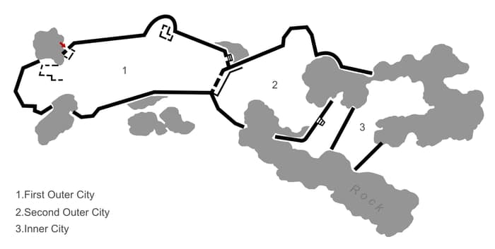
- Its walls are more than 2 metres thick at the base and reach up to 12 metres in height, enclosing three courtyards linked by gates and a total area of 10,210 square metres.
- Natural rock saved the builders much of the work: walls were needed only on two sides, as cliffs up to 70 metres high closed in the rest.
- According to the Polish Wikipedia article, plaques in Bulgarian and Turkish commemorate the early nineteenth-century rebuilding, said to be the only such case among Turkish fortresses.
- Excavators found a rock-cut water reservoir of 85 square metres, fed by rainwater and snow channelled into it.
- The fortress is one of the Hundred National Tourist Sites of Bulgaria, and it has a stamp for collectors of that route.
Tours near Belogradchik Fortress
Experiences in the area that you can book online with Viator:


Visiting Belogradchik Fortress: what to expect
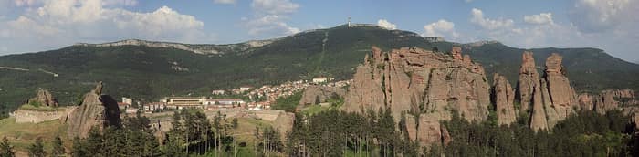
- The fortress stands about 1.5 km from the town of Belogradchik, set among the Belogradchik Rocks, which together form the region's main draw.
- Two main gates lead in, Vidin Kapia and Nish Kapia, and the interior is divided into three fortified courtyards connected by gates.
- Look for the high rock faces that close the courtyards, the thick walls with loopholes and the remains of the old water system.
- The fortress is managed by the local historical museum; check the current opening hours and visiting conditions before you go.
- Other places of this guide nearby include Magura Cave (about 12 km), Ratiaria (about 29 km), Castra Martis (about 32 km) and Albotin Monastery (about 42 km).
Opening hours, access and conditions can change. Check before you go.
Map: where Belogradchik Fortress is
Photos of Belogradchik Fortress
Questions
What is Belogradchik Fortress?
Belogradchik Fortress, also called Kaleto, is a well-preserved stronghold on the northern slopes of the Balkan Mountains. It began in Roman times and was extended in the Middle Ages and by the Ottomans.
Where is Belogradchik Fortress and how far is it from the town?
It stands in north-western Bulgaria, about 1.5 km from the town of Belogradchik, among the Belogradchik Rocks.
How old is Belogradchik Fortress?
The first fortress dates from Roman times, between the first and third centuries CE according to different sources. It was enlarged in the fourteenth century, taken by the Ottomans in 1396 and rebuilt between 1805 and 1837.
Why does the fortress have walls on only two sides?
Natural rock formations up to 70 metres high close in the other sides of the courtyard. Walls were built only on the north-west and south-east.
Was Belogradchik Fortress used in recent wars?
It played a role in the Ottoman suppression of the Belogradchik Uprising of 1850 and was last used in warfare during the Serbo-Bulgarian War of 1885.
What else is worth seeing near Belogradchik Fortress?
The Belogradchik Rocks lie right beside it, and Magura Cave is about 12 km away. The Roman site of Ratiaria is about 29 km away.
Also nearby

Magura Cave
Belogradchik · cave of 750 prehistoric paintings made of bat guano
12 km away
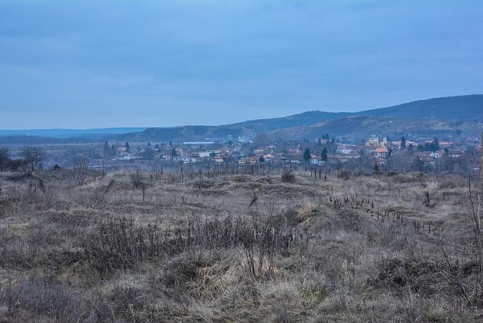
Ratiaria
Vidin region · Roman Danube colony and capital of Dacia Ripensis
29 km away
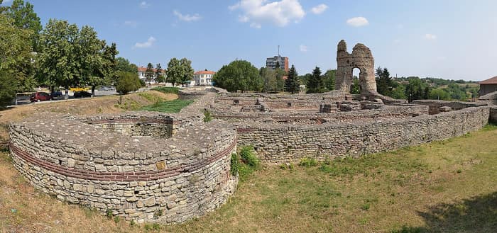
Castra Martis
Kula · late Roman fortress and the tower that named a town
32 km away
Albotin Monastery
Deleyna · 14th-century rock monastery and Easter dances
42 km away